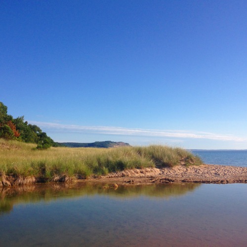
North Bar Lake, photo by Sarah Hunt
Who’s ready for a break from snow & ice? The Sleeping Bear Dunes National Lakeshore page on the North Bar Lake Overlook says (in part):
The name describes how the lake formed: it is ponded behind a sand bar. At times, the sand bar builds up and separates North Bar Lake from Lake Michigan. At other times, a small connecting channel exists between the two lakes. North Bar Lake occupies part of a former bay on Lake Michigan. This ancient bay was flanked by headlands on both sides: Empire Bluffs on the south and Sleeping Bear Bluffs on the north. Shorelines have a natural tendency to become straighter with time. Wave action focuses on the headlands and wears them back, while shoreline currents carry sediment to the quiet bays and fill them in. Deeper parts of the bay are often left as lakes when sand fills in the shallower parts.
The same process that formed North Bar Lake also formed many of the other lakes in northern Michigan: Glen, Crystal, Elk and Torch Lakes, for example.
Here’s more about the geology of the Sleeping Bear and more about North Bar Lake, to which I’d add that the lake is a great place for skim boards because the channel between North Bar & Lake Michigan is only a few inches deep!
Sarah took this photo last summer. Click it to view background bigalicious and check out lots more of her incredible and adventurous photography at instagram.com/oni_one_.
PS: If you’re still not full-up on winter and ice, might I suggest this pic she took in this area of Sleeping Bear last week!


Looks like such a peaceful place!
LikeLike
It is Constance … sometimes. In summer it’s a pretty busy beach though. The nice thing about Sleeping Bear however is that you can walk about 5 minutes and be totally alone!
LikeLiked by 1 person
Hi, I have some great pictures . How can I get the opportunity to have you post? Thanks! Dianne Carroll Burdick
LikeLike
Hi Dianne, all the details are on the Michpics How-to: https://michpics.wordpress.com/michpics-how-to/
LikeLike