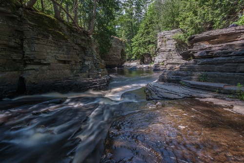

Sturgeon River, photo by Sven
While the ice has melted, leaving the shorelines temporarily free of peril – at least until until bodysurfing season starts – we can take a moment to worry about quicksand. Quicksand in Michigan Streams from Fichigan says:
Everything I know about quicksand I learned from Tarzan movies. The main thing to know is: bad guys don’t make it out, but good guys and gals always do. If you’re a bad guy, please stop reading. Quicksand on a trout stream is a little different than sand bogs in Africa, but there’s some similarity. They are both camouflaged so you don’t see it until it’s too late and if you make it out alive you’ll have an interesting story to tell even if no one believes you.
Quicksand on a trout stream is harder to see since it’s underwater. The stream bottom appears normal except there is no visible hole (sand covers it) so you don’t know it’s here until you start sinking. In waders it’s pretty scary since swimming doesn’t feel like an option.
I’ve found quicksand on the Pine River in Lake County and the Sturgeon River in the Pigeon River State Game Area. On the Pine, the particular spot I know of is a few bends downstream from Raymond Road. The first time I ran into it I was alone. I scrambled to get out and it was like running in place up a sand dune. It was easy to see the exact spot afterwards because a cloud of light gray silt poured out like smoke. An hour later, walking the bank downstream, the silt was still pouring out.
Read on for lots more including his encounter on the Sturgeon River.
I can find photos of almost anything View Sven’s photo bigger on Flickr and see more in his UP Michigan slideshow.
The Sturgeon River is one of Michigan’s Wild & Scenic Rivers – more Sturgeon River on Michigan in Pictures.