
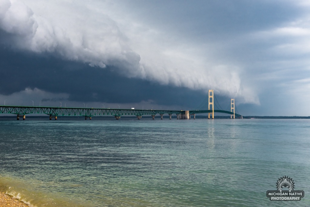
Shelf Cloud Over Mackinac Bridge by Michigan Native Photography
I saw a couple other photos of this cloud as it rolled across the Straits of Mackinac & northeast Michigan the other day but wowzas – the Mighty Mac takes it!! Our friends at the Earth Science Picture of the Day have an excellent post on the difference between roll clouds & shelf clouds:
Roll clouds and shelf clouds are found near the leading edge of thunderstorms and form when relatively cool air, from the storm’s downdraft, forges ahead into the warm, moist air that’s feeding the storm. The main difference between roll clouds and shelf clouds (both are called arcus clouds) is that a roll cloud is detached from the parent thunderstorm, whereas a shelf cloud (right) is affixed to the base of a cumulonimbus cloud.
NOTE: Just learned that this picture is from 2018 – still love it! (buy it here)
You can follow Michigan Native Photography on Facebook or Instagram and view & purchase more work on their website.
There’s more weird, wild Michigan weather on Michpics including a monster roll cloud over Lake Michigan from June of 2016.