This could be your front porch!!

Mouth of the Hurricane River

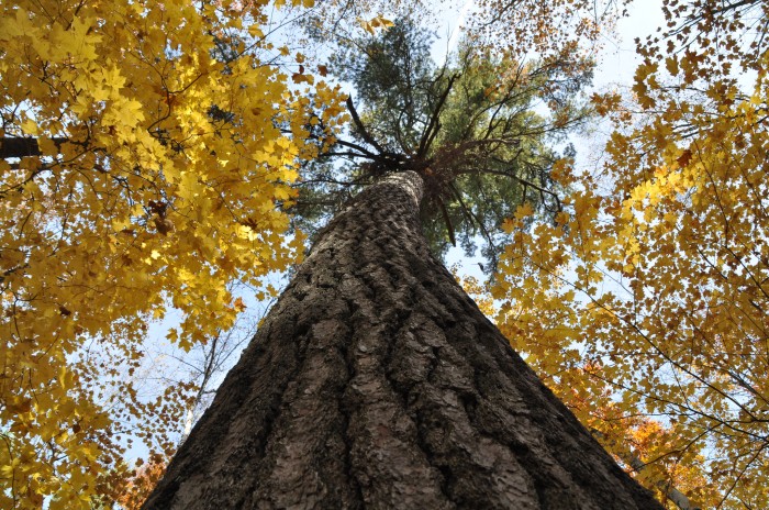
“Lonely Goose” Mouth of the Hurricane river by Michigan Nut Photography

The Pictured Rocks National Lakeshore asks if you’ve ever thought about being a campground host?

If the answer is “Yes!” they are seeking a volunteer campground host for the month of June at Hurricane River Lower Campground. Volunteer campground hosts work 5 days a week and stay in a designated campsite, assisting fellow campers with information and registration, but they do not handle any money, and do not clean restrooms. Campground hosts are welcome to bring their own RVs and campers, though there are no electric or sewer hookups (vault toilets are available) and cell reception is limited.

Hurricane River Campground is on the eastern side of Pictured Rocks National Lakeshore, about 12 miles outside of Grand Marais. The campground sits above a sand and pebble beach on Lake Superior, which is dotted with shipwrecks as it stretches east towards the Au Sable Light Station.

It’s an awesome spot – learn more & apply on the Pictured Rocks National Lakeshore website!

John took this photo of a lonely goose at the mouth of the Hurricane River way back in 2012! For sure view & purchase prints from Pictured Rocks & elsewhere on his website!!

Support Michigan in Pictures with Patreon

Before & after the fall at Miner’s Castle

Miner’s Castle before it fell by Sue Spaulding & Miner’s Castle (post-collapse) by Arie Koelewyn

17 years ago today, one of Michigan’s most notable rock formations became less notable when the northeast tower of this distinctive formation collapsed. The day after, the Pictured Rocks National Lakeshore reported:

On Thursday morning, April 13, 2006, the northeast turret of Miners Castle collapsed. One turret remains on Miners Castle, the best-known feature of Pictured Rocks National Lakeshore. The collapse was reported via cell phone by fisherman in the area, according to chief ranger Larry Hach.

Most of the rock fell north and into Lake Superior, and there were no injuries. The lower overlook platform near Miners Castle appears to be unaffected.

While the rockfall at Miners Castle on April 13 was startling, such events are not rare along the Pictured Rocks escarpment. At least five major falls have occurred over the past dozen years … Rockfalls along the cliffs typically occur in the spring and fall due to freezing and thawing action of Mother Nature.

You can read more & see more photos in this Absolute Michigan article on the collapse of a turret at Miner’s Castle.

Shalda Creek Iris

via leelanau.com…Shalda Creek Iris by Michigan Nut Photography

Shalda Creek Iris by Michigan Nut Photography

John got this shot of wild Iris along the banks of Shalda Creek in the Sleeping Bear Dunes National Lakeshore.

See more on the Michigan Nut Facebook page and at michigannutphotography.com.

Support Michigan in Pictures with Patreon

Waterfall Wednesday at Wagner Falls

Wagner Falls and Marsh Marigolds by Footsore Photography

Wagner Falls and Marsh Marigolds by Footsore Photography

Pure Michigan shares that the Wagner Falls Scenic Site near Munising:

…is nestled amongst virgin pine and hemlock trees. There is a small parking area and a half-mile trail with an observation deck overlooking the falls. Wagner Creek falls over a stratum of erosion-resistant dolomite into order to flow into a shallow gorge containing the Anna River. The Anna, soon afterwards, flows northward into Lake Superior.

Gary shared this last week in the Michigan in Pictures Facebook group where you can see photos from Michpics readers & share your own!!

You can follow Gary at Footsore Fotography on Facebook and view & purchase his work on his website! 

Support Michigan in Pictures with Patreon

Round Island Ripples

Round Island Light 2022 by S.Hughes Photos

Round Island Light 2022 by S.Hughes Photos

“We are here but for a second, but our impact ripples through time.”
― Neetal Parekh

The Wilderness Connect entry for Round Island says in part:

The United States Congress designated the Round Island Wilderness in 1987 and it now has a total of 375 acres.

All of Round Island has been designated wilderness except one acre on the northern tip, a sand and cobblestone spit where the lighthouse stands. There has been no logging on the island since the turn-of-the-century. There are no docks, roads, or developed hiking trails on the island. Access is by boat in the summer and over ice in the winter. Several historic and prehistoric sites exist on the island.

…The “Michigan rattler”, massausauga has been rumored to reside on the island. You may see whitetail deer, raccoon, red squirrel, fox, rabbit, and an occasional black bear on the island; as well as a variety of songbirds and waterfowl. Trout, pike, salmon, and other freshwater fish are found in the lake waters around the island. While the island is removed from the hustle and bustle of everyday life, it is close enough that you can see busy Mackinac Island and the mainland lights.

More information about the Round Island Wilderness Area from the US Forest Service.

While I’ve shared a number of photos of the Round Island Lighthouse taken from the Mackinac Island Ferry over the years, I’ve never seen a shot from taken from on Round Island! Follow S. Hughes Photos on Facebook for lots more.

Support Michigan in Pictures with Patreon

Hartwick Pines donor honored

Hartwick Pines State Park by James Salinas

Hartwick Pines State Park by James Salinas

mLive shares that the woman whose donation created Hartwick Pines State Park has been honored by the Michigan Environmental Hall of Fame:

Nearly 100 years ago, a Grayling woman named Karen Hartwick bought and then donated to the state of Michigan an 8,000-acre parcel containing a rare and precious grove of pristine virgin pine trees.

The donation was significant for a woman acting alone at that time, but also considering that Hartwick’s father had made his fortune from the logging boom that had leveled much of Michigan’s ancient forests.

…Hartwick’s vision gave Michigan its beloved Hartwick Pines State Park, and it’s continued to keep that land safe in the century that has followed. As recently as a decade ago, the original “spirit and intent” of Hartwick’s donation was invoked as reason for the state to drop the land from an auction that would have allowed drilling exploration underneath those prized old-growth pines.

Lots more at mLive, visit the Environmental Hall of Fame & learn more about Hartwick Pines on Michigan in Pictures.

James took this photo way back in 2010. You can see more in his Hartwick Pines State Park gallery on Flickr.

Support Michigan in Pictures with Patreon

Red Flag Fire Danger today!

Forest Fire - Sleeping Bear Dunes by Todd

Forest Fire – Sleeping Bear Dunes by Todd

mLive shares that the northern half of Lower Michigan has a red flag fire warning today, meaning that the warm, dry, windy conditions allow wildfires to not only start easily, but also spread quickly. Much of the lower peninsula is dry as well so PLEASE careful with fire today!!

Todd took this back in 2018 on a Sleeping Bear Dunes National Lakeshore trail. He shares, “The scene was surreal as the flames wound their way through the forest. It was disturbing and beautiful at the same time. No one else was around to experience it.”

I bet!! See more in his Sleeping Bear Dunes gallery on Flickr.

Support Michigan in Pictures with Patreon

Embrace Michigan’s Dark Skies!

Dark Skies at Rockport Recreation Area by SG Captures

Dark Skies at Rockport Recreation Area by SG Captures

Michigan State Parks, Trails and Waterways shared this photo from the Rockport State Recreation Area, asking: What are you doing to do to celebrate #InternationalDarkSkyWeek?

Michigan is lucky to have designated areas that host spectacular nighttime viewing. Dark sky parks and preserves have a limited amount of artificial light, making it easier to stargaze in those locations. Dark sky preserves are designated by Michigan legislature and dark sky parks are designated by the International Dark Sky Association. The six state parks that have dark sky preserves are:

In addition to these dark sky preserves, there are two dark sky parks in Michigan:

And if that’s not enough, there is also plenty of excellent night-sky viewing opportunities across more than 15,000 square miles in Michigan’s Upper Peninsula. For more details, visit Michigan.gov/DarkSky.

Sarah is a Michigan State Parks Photo Ambassador, and you should definitely check out her website where you can view & purchase her work as well as her Facebook & sg.captures on Instagram!

Support Michigan in Pictures with Patreon

Springtime at Root Beer Falls

Tahquamenon Falls in Michigan's UP by Tom Clark

Tahquamenon Falls in Michigan’s UP by Tom Clark

Tom swung by Tahquamenon Falls over the weekend and shares:

Amazing! I have never seen it with such a large volume and flow as today. It’s supplied by the spring melt-off and rain. Another benefit of the run-off is the intensity of color – again, never seen such deep rich color. That is why it’s aptly referred to as “root beer falls”.

Indeed!! See more in Tom’s UP Trip with Dave – April 2022 gallery on Flickr & view & purchase his work on his website.

Much more from Tahquamenon Falls on Michigan in Pictures!

Support Michigan in Pictures with Patreon

Fallen

Pictured Rocks National Lakeshore by Stephen Trynoski

Pictured Rocks National Lakeshore by Stephen Trynoski

Stephen took this shot of two massive slabs of fallen rock in the Pictured Rocks National Lakeshore back in 2015. See more of Lake Superior in all four seasons in his gallery.

Support Michigan in Pictures with Patreon