Ghost forest at Silver Lake Dunes

Ghost forest at Silver Lake Sand Dunes by Martin Hogan

The Silver Lake State Park page at Michigan Trail Maps says in part:

Not all of Michigan’s great hikes are trails. This trek is a journey through Silver Lake State Park’s trailless backcountry, a mile-wide strip of dunes between Silver Lake and Lake Michigan. There’s not another hike like this in Michigan or even the Midwest because no other stretch of dunes are so barren.

Perched on a plateau and rising more than 100 feet high above Silver Lake, the heart of these dunes are totally devoid of any vegetation, even dune grass. The only thing besides sand are the stumps and trunks of ghost forests, ancient trees that the migrating dunes had buried and killed. Almost half of the hike is in this Sahara Desert-like terrain, the other half is spent strolling a stretch of Lake Michigan that is free of cottages and frozen custard stands.

A rare hike indeed.

It’s good to feature a photo from Martin again – follow him on Facebook for more!

Support Michigan in Pictures with Patreon

The Mighty Mac

Mighty Mackinac by Greg Jarman

Mighty Mackinac by Greg Jarman

UP TV-6 shares that the Mackinac Bridge Authority is expecting about 20,000 crossings of the bridge this weekend, about the same as 2021. Whether you’re traveling or staying put this weekend, I hope you have a good one & remember those who have put their lives on the line for this country.

Greg took this photo back in 2016. See more in his Print gallery on Flickr.

Lots more about the Mighty Mackinac Bridge on Michigan in Pictures.

Support Michigan in Pictures with Patreon

Happy 185th Birthday, Michiganders!

Mighty Mac at 50 by Julie

Mighty Mac at 50 by Julie

On January 26, 1837 Michigan was admitted to the Union as the 26th state. The Freep has a feature with some fun facts about Michigan a few years ago. One that caught my eye was this one:

What’s a Michigander?

The term many of use and love today was coined by none other than Abraham Lincoln in 1848. Then an Illinois congressman, Lincoln referred to Michigan governor Lewis Cass, who was running for president as a Democrat, as a “Michigander”, meaning he was as silly as a goose. Lincoln was mad at the Democrats for making more than they should have of Cass’ military experience, and the term was meant as an insult. “There is one entire article of the sort I have not discussed yet;” Lincoln said, “I mean the military tale you Democrats are now engaged in dovetailing onto the great Michigander.”

They note that while neither is official, many prefer “Michiganian.” I have always been a fan of Michigander, but I confess this fact is making me reconsider!

Julie took this photo at a big birthday for Michigan, the 50th anniversary of the opening of the Mackinac Bridge which (IMO) is what made Michigan, Michigan.  See MANY more photos in her Michigan album on Flickr & enjoy our collective birthday!

Support Michigan in Pictures with Patreon

Holland gets high marks for quality of life

The Big Red by Ayman Haykal

The Big Red by Ayman Haykal

The Great Lakes Echo shares that Holland ranks first in quality of life for Michigan small cities:

This small city nestled off Lake Michigan ranks number one in the state for quality of life in “Best Small Cities in America,” a study published by WalletHub, a personal finance website that tracks financial and other trends. It is one of five measures the study used to rank the desirability of small cities. (The other measures are affordability, economic health, education and health, and safety.)

Quality of life was assessed by measures like average commute time, city walkability and number of bars, restaurants and cultural centers per capita.

Holland, Kalamazoo, Flint, Muskegon and Saginaw ranked in the top five of 39 small Michigan cities for the quality-of-life measure. The state’s lowest were Holt, Eastpointe, St. Clair Shores, Lincoln Park and Garden City.

You can read more in the Echo & see all the cities in the study at WalletHub. Also, Traverse City, Marquette, Petoskey – you weren’t in the study so continue thinking whatever you think about yourselves.

In all seriousness, “studies” like this are basically nonsense, but I’ll take any excuse for a banger photo of Big Red like this one! Ayman took this pic back in 2019. See more in their Lighthouses gallery on Flickr.

Lots more about Holland Michigan on Michigan in Pictures!

Support Michigan in Pictures with Patreon

Waterfallish Wednesday: Seasons Greetings from Fishtown

via Leelanau.com…

Flowing All Night Long by Mark Smith

Flowing all night long by Mark Smith

While this dam isn’t an actual waterfall, I’m going to overlook it due to seasonal appropriateness. In their excellent overview of the history of Fishtown in Leland, the Glen Arbor Sun shares:

Fishtown is located where there once was a natural fish ladder on these traditional Native American fishing grounds. It is one of only few commercial fishing villages still operating today in Michigan. The Native Americans called this spot Mishi-me-go-bing, or alternatively Che-ma-go-bing or Chi-mak-a-ping, meaning “the place where canoes run up into the river to land, because they have no harbor.”

French Canadian millwright, Antoine Manseau, along with his family, are thought to be among some of the first whites to settle here. They came from North Manitou Island in 1853. The following year Manseau and his family, along with John Miller, built the dam at Fishtown. It raised the water level in the river and in Lake Leelanau by as much as an astonishing 12 feet. Since the dam prevented boat traffic from going back and forth in their daily business, launches were, and still are provided on both sides of the dam.

Lots more in the Sun. You can learn more about the history of the dam from Fishtown Preservation.

Mark took this photo a week ago. See more in his Leland gallery & view and purchase his work at Leelanau Landscapes.

Support Michigan in Pictures with Patreon

Wandering the sands of time

Sleeping Bear Dunes 1940 by Fredrick W Dickinson

Sleeping Bear Dunes 1940 by Fredrick W Dickinson

“What has been lost may yet live in memories.”
-Christopher Paolini

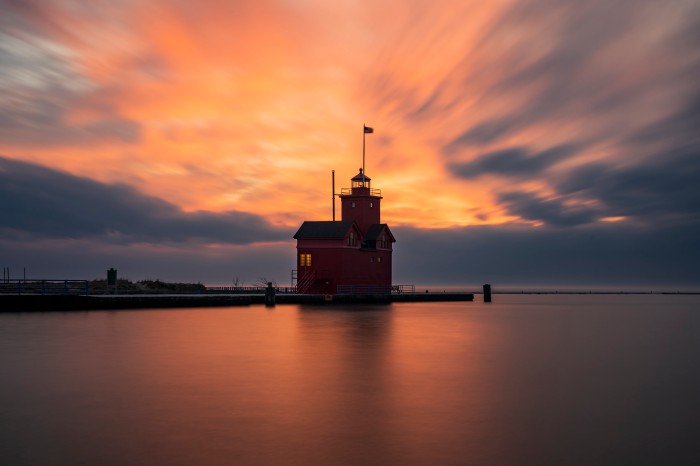
This morning a reader commented on John McCormick’s photo of the Au Sable Point Lighthouse that I shared last week, saying “This was an incredible shot, and I think of it whenever I go out to the lighthouse. I doubt that shot can be duplicated now; there are lights all along the foundation of the building, and the beacon is no longer operating.” That got me remembering other Michigan scenes that are lost to us except in photographs & one that was right in my backyard!

While the  that “the Bear” was also an actual formation atop a dune about a mile north of the Pierce Stocking Overlook. The Sleeping Bear Dunes National Lakeshore says that the formation pictured above known as “the Bear”…

…hardly looks like a bear now, for it has been changing rapidly in recent years. At the turn of the century, it was a round knob completely covered with trees and shrubs. You can still see some of the thick vegetation that gave it a dark shaggy appearance.

…For a long time, the sleeping Bear Dune stood at about 234 feet high with a dense plant cover. However, trough most of the twentieth century, erosion has prevailed. By 1961, the dune was only 132 feet high, and by 1980, it was down to 103 feet. The process is a continuing one. The major cause of the dune’s erosion was wave action wearing away the base of the plateau on which the dune rests. As the west side of the dune loses its support, it cascades down the hill. The wind, too, is a major agent of erosion, removing sand and destroying the dune’s plant cover.

The photo above was taken by Leelanau photographer Fred Dickinson. On Michigan in Pictures there’s a photo of Fishtown in 1940 that explains Dickinson’s hand coloration technique and another shot by Fred of some folks taking a break from a Sleeping Bear Dune ride.

Definitely check out the Dickinson Photo Gallery to view & purchase great photography of the dunes & other Leelanau locations. The gallery is still run by his daughter Grace who also colorizes photos. 

You can see a couple more photos of the Bear from MSU & click over to Leelanau.com for the Legend of the Sleeping Bear

Support Michigan in Pictures with Patreon

Banded Iron Formation of Jasper Knob

Banded Iron Formation by Linda Grashoff

Banded Iron Formation by Linda Grashoff

Back in August of 2007, Linda & her husband took one of their many trips to Michigan’s Upper Peninsula & visiting Grand Marais, Ishpeming and Copper Harbor. She visited the Jasper Knob just outside of Ishpeming & writes:

It is a banded iron formation. The layers consist of jasper (the red rock) and hematite (the silvery rock). I’m delighted to tell you that some biogeologists believe that banded iron formations were formed by my old pals, the iron bacteria.

Head over to her photo blog for a lot more pictures and for sure check out her book They Breathe Iron for more about iron bacteria.

Support Michigan in Pictures with Patreon

Happy Holidays from the Loon Song Covered Bridge

Untitled by Steve Nowakowski

Untitled by Steve Nowakowski

The Loon Song Covered Bridge aka Joshua’s Crossing is a covered bridge in Lake Ann that was built in 1995 so that guests could access the back of the Herendeen Lake Resort property. The 90-foot bridge crosses a ravine and small creek and was named after Joshua Gabrick, son of resort owner Mark Gabrick. You can get more info about the privately owned bridge on their Facebook page. They’re also selling home sites in case you feel the need to drive across this on the regular!

You can see a lot more views of this idyllic landmark in Steve’s 2016 Lake Ann Covered Bridge gallery on Flickr.

Happy Holidays everyone – see you next week!! 

Support Michigan in Pictures with Patreon

Internationally Lit

sault ste. marie international bridge, michigan by twurdemann

sault ste. marie international bridge, michigan by twurdemann

The International Bridge at Sault Ste. Marie is the only vehicular crossing between Ontario and Michigan within a 300-mile distance, connecting the sister cities of Sault Ste. Marie across the St. Mary’s River.

See more in twurdemann’s International Bridge gallery on Flickr.

Support Michigan in Pictures with Patreon

High Rollaway Horseshoe

High Rollaways Horseshoe by Alanna St Laurent

High Rollaways Horseshoe by Alanna St. Laurent

Traverse City MI explains the name for the High Rollaway, officially the Manistee River High Banks Rollaway:

The high river bluff is the reason for the area’s unusual name. At the turn of the last century, lumbermen needed inexpensive ways to transport timber from the forest to the sawmills and wide-flowing rivers like the Manistee were the answer. Steep banks were used to “rollaway” the logs in a thunderous avalanche to the water where they floated to the mills. Unfortunately, the practice quickly stripped the vegetation from the river banks and, by the time the lumbermen moved on, eroding sand was clogging and narrowing the rivers. In the last 20 years, efforts have been made to stabilize the Manistee River High Banks with fieldstone terraces and replantings. The observation platform was installed in 2001 so visitors could enjoy the stunning view without damaging the fragile system.

Alanna took this stunning photo with her drone last week. Follow her on Facebook for lots more great shots & check out her photography workshops at Creative Visions Photographic Workshops!

Support Michigan in Pictures with Patreon